Friday, December 29, 2006

Release Date 12/27/2006


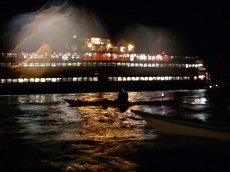
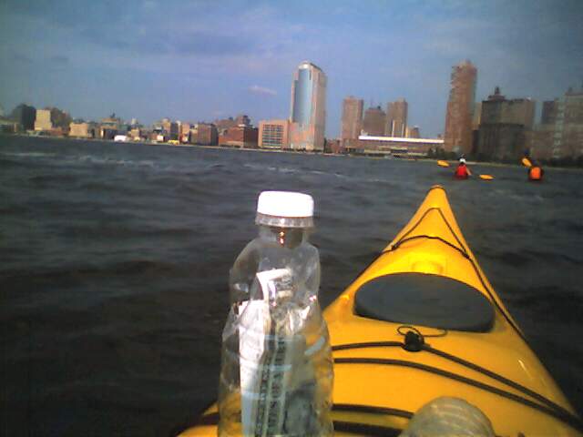
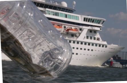
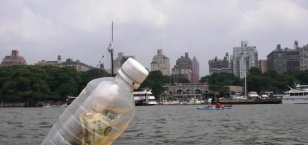
Released this message on the Colorado River in Utley Texas.


I was visiting Relatives and I rented a kayak to do a trip on a local river.

All the rivers in this area, hill country outside of Austin, are controlled by dams. The state water control authority maintains a paddling trail and map. See http://www.lcra.org
I put in at the second entry at Webberville, what the locals call "new park". It was a 12 mile paddle down the river. Even though it had been raining earlier in the week, the water was pretty low because they weren't letting much out of the dam. There was a light current going with me down the river, at a few points where the river narrowed or got really shallow the current would pick up to a knot or two, but most of the time it was insignificant.

Apparently the river goes all the way to the Gulf of Mexico. This looks like it would be a great multi-day trip to do sometime when there was more flow. The land along the banks is private, but there are some islands where camping is allowed, or at least let to happen.

I went through a number of farms, and saw cows. I think that is the first time I've ever seen a cow from my kayak. There were pecan orchards, but much of the land was fairly wild.
In the summer or spring it must be very beautiful, but this time of year the leaves were off the trees.

There were lots of ducks on the water, and I saw a man and his son hunting them at one point. Fortunately they were just setting out the decoys when I arrived, not actively hunting.


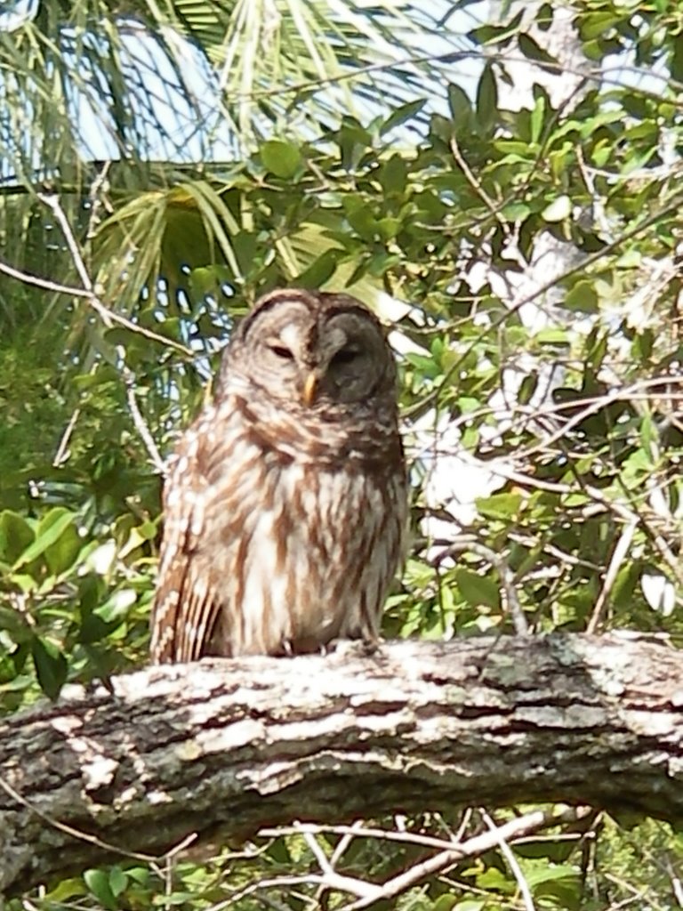
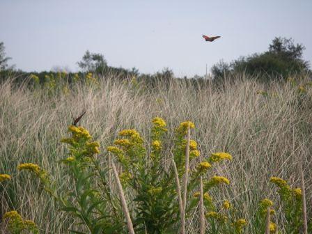
When I went around one bend I saw a large coyote drinking on the bank. I also saw lots of herons, hawks, and a variety of other birds.

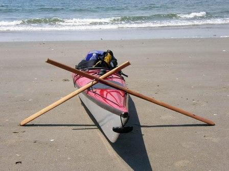
In a few spots the water was so shallow I had to push the boat with my hands, but I never had to get out. I did the 12 miles in 3 hours 45 minutes, with about a 1/2 hour break for lunch. I had rented a Wilderness systems tempest 165. I was pleasantly surprised it had a very low volume, and fit me well. The wouldn't rent me a spray skirt, so I didn't get a chance to edge it, but for a plastic boat it seems really nice. It has a skeg and day hatch. I'd love to try it in the ocean.

When I got to the end there were some locals having beers under the Bridge, see the picture above. They were a fun group, and gave me a beer after I showed them how to use the CD player they had received for Christmas.

In 1991 there was a large flood, and the water was up to the very top of the bridge!!.


I was visiting family in Austin Texas for the Holidays and decided to rent a kayak to take a trip down the Colorado River that runs through the Texas Hill Country.

All of the water in this area of Texas is controlled by a series of dams. The dams serve 3 purposes, flood control, drinking and irrigation water, and electricity generation. A side effect is a long series of contiguous water running for hundreds of miles all the way to the Gulf of Mexico.

The public agency that manages the dams is called the Lower Colorado River Authority. Their very complete website, http://www.lcra.org/, contains directions for ordering a paddling guide. I didn’t have a copy, but there was a nice a map at the put-in.
{picture full_map.jpg}

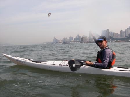
I decided to just do a day paddle with a rented kayak. The first surprise was at the kayak rental company in Austin. After talking to a few of them I settled on Austin Canoe and Kayak, http://www.austinkayak.com/. They had a wide variety of recreational boats, that were not suited to serious paddling, but they did have one sea kayak, A Wilderness Systems Tempest 160, for sale. Since it was winter, and very slow I convinced the bored owner to rent it to me. He just took the price-tag off, I paid him $35, signed their waiver, he gave me a PFD and a paddle and I was on my way. They didn’t look at my license or take a credit card imprint. I guess they didn’t realize I was from New York. It probably had something to do with the pick-up truck I had borrowed from my brother that had Texas farm plates on it.

I drove south of town to the put in. This is farm country in Texas, and fairly rural. The sign at the business near the park summed-up the local people’s attitude about how to handle problems with their neighbors.
{picture warn_sign.jpg}

I launched at the Big Webberville Park. One concern was that I wouldn’t be able to get through because no much water was being released from the dams, and it hadn’t rained much.  I talked to a couple of fishermen who had a small motorboat, and they told me there was plenty of water all the way to the bridge at Farm Road 969 where I planned to take out. There were a few shallow spots where the boat rubbed on the bottom, but I didn’t have to get out.

It was a quiet lazy paddle. In the summer it is probably very beautiful, but it was a little barren because all the leaves were off the 
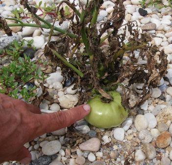
trees. I went through a number of farms, and when I rounded one corner I was face to face with a big cow. It seemed odd after all the ocean paddling I have done to be starring at a huge cow right in front of my boat.
{picture cow.jpg}

I saw a variety of real wildlife, great blue herons, ducks, hawks, turtles, and even a large coyote. The ducks and coyote were the most skittish, probably because both of these animals are often shot by the local people. The ducks are hunted for sport, the coyotes are killed because they are a threat to farm animals.
{picture hawk_sit.jpg, turtle.jpg}

I continued to paddle down the river. Numerous warning signs indicated that all the land was private and posted, but there are a number of sandbars on the river that are suitable for rest stops or even camping on longer trips. I had lunch on a gravel bar.
{picture lunch_bar.jpg}

I only saw a few people over the entire 4 hour trip. There was a man and his son putting out decoys for duck hunting. I was glad that they were just getting set-up, since every time I rounded a corner I flushed a flock of  ducks into the air from the water.

When I reached the take-out I encountered a group of local people who had set-up a card table and were drinking beer and bourbon. I chatted with them for a little while, and helped them figure out how to work their new CD player. They  thanked me with a beer. When my brother came to pick me up the locals greeted him. He had picked up some other friends in a canoe during the summer, and this same group was sitting and drinking in the same spot. They thought it was last week, but my brother assured them it had been 6 months ago.


This area is subject to large floods. In 1991 the water over ran the dams and the authority lost control of the river. The water flooded all the way to the bottom of the roadway on the bridge. A small marker in the pavement indicated the high water mark.


All in all it was a fun, and very different paddle. I’d love to come back in the spring when the water is a little higher and faster, and go all the way to the Gulf of Mexico, 300 miles, camping along the way.


Thursday, December 07, 2006

Release Date 12/06/2006


Did a circumnavigation of Manhattan for the New York Kayak Company.

We planned to leave at 08:00 AM and do the traditional counterclockwise paddle route. High water at the Battery was at 08:40, low water at 15:20. Since it was a fast group we would have paddled against the current down to the Battery, then had the current the whole rest of the way. Wind was from the Southwest at 15kts.

There were problems getting underway, so we weren't able to leave until 09:30. Based on the currents we decided to instead attempt a clockwise route, up the Hudson, Down the East River. The conditions weren't too bad, but the rear quartering wind made for a lot of weathercocking. My skeg was not working, so it was a bit of a workout. We arrived at Spitendival around 11:30, had a quick lunch, and were back underway down the Harlem by 12:00. The Harlem paddle was difficult, against both the current and the wind.

We arrived at Randalls Island around 14:15 for a short break, and were back on the water headed down the East River by 14:30.

The East River paddle against the wind was also very slow going. The current was stronger up near Rosevelt Island, but there was virtually no current assist by the time we reached 23rd St, and near the Battery the wind was stronger than the current. We did get to see a dramatic sunset behind the Brooklyn Bridge. I was peddling over the bridge in the morning, so it seemed fitting that we paddled under in just as the sun was setting.

There was very heavy ferry traffic all around the Battery, and the swell was about 4ft when we turned into the Hudson. We stopped at North Cove around 17:30. It was very dark by then so we got some lights and then continued onto the Kayak shop by 18:30.

Truth: Most tasks take longer than you expect them to.

Friday, December 01, 2006

Release Date 11/21/2006


Released this message while Hog Hunting in the Suwannee River National Wildlife Refuge. The score was Hunters 0 Hogs 3. We didn't see a single one so we went home hungry.
The weather was cold in the morning, but really nice, warm and sunny in the afternoons. I released the bottle just as the sun was setting in mouth of the river from the airboat, as we were coming home on the last day. Since we usually hunt from Sun-up to Sun-Set. Just stunning scenry.
One morning while sitting in a tree waiting to kill something the Owl pictured above landed on a nearby limb. It was daytime, but he seemed really sleepy. He just sat there for an hour or so, and didn't even fly away when I climbed down for lunch.

Thursday, November 16, 2006

Release Date 11/2/2006


Released the bottle off of West coast of Milos around 11:00 AM. We were continuing our paddle around the island.

The weather was perfect, the wind had shifted to be from the South, just as we rounded the corner and started up the West coast, so we surfed most of the way.

Stunning scenery with a huge number of dramatic cliffs coming down to the water, all kinds of different rocks and soil. The coast was also covered with large sea caves that we could paddle into and out of.

The Island in the picture is off of the West Coast of Milos, and called Antimilos. It looks really cool, just a mountain rising up out of the sea. That morning it was especially beautiful because the top of the mountain was covered in a cloud.

One of those paddling days that is just perfect. Not to hot, not to cold, tail wind, dramatic scenery, every once it while you just had to just look up, smile, and say "wow".

Truth: Sunsets can be beautiful, you feel better if you stop appreciate them.

Release Date 10/30/2006


Released the message off of the Southern Coast of Milos Greece. We were doing a kayaking and camping trip paddling around the Island.

We had spent the night at the site of an abandoned sulfur mine on the Southern Coast. It was a very dramatic environment with a huge array of old buildings and machinery. The mine was abandoned in the 1960s, and everything beds, tools, equipment just left there. Funny thing was you could still sulfur deposits on the ground and smell the sulfur.

I released the bottle on the next morning. Right afterward we were exploring an old settlement along the coast, and I found a volcanic hot spring. After moving some rocks around we were able to have spitz bath before lunch.

Later in the day I was kayak fishing away from the other paddlers when I came upon large sea turtle. She was just resting on the surface, and I was able to paddle right up to her. In Florida the turtles are very skitish, but this one just calmly looked at me, and paddled around. Eventually she dived.

We got off the water that night since a massive storm came through, force 6 winds and tremendous rain and lighting. We watched from a bar, spent the night in a hotel, and the next day touring the island until the storm blew over.

Release Date 10/27/2006


Released this message while scuba diving off of Milos Greece. We actually were diving off the coast of a small island adjacent to Milos, called Kimilos.

It was the end of the diving season, and the operator, Milos Diving, said it was their last week for the year.

The water was cool, about 70 degrees. This was a wonderful dive. We went along a limestone ledge viewing sponges, and Octopi (not sure if that's correct...)

Visibility is excellent in Greece, 70 or 80 feet.

It's so funny the underwater environment totally reminds me of the Gulf of Mexico off of the West Coast of Florida. Limestone features with patches of eel grass and sponges, but no coral. I noticed a number of the fish are the same. The geology is MUCH more dramatic in Greece, with ledges plunging hundreds of feet very close to shore.

On the way back to the boat we went into a sea cave. It was dark, but the cave extended above the surface, so it wasn't technically an overhead environment. It was very beautiful, and full of shrimp in the back of the cave.

Release Date 10/21/2006


Released this message in Cold Spring New York.

It was a beautiful sunny day, and the leaves were just turning. Really nice colors in the trees on both sides of the river.

We had planned to paddle from Cold Spring to Bannerman's Island, but because of heavy winds, 20 plus knots we turned back before reaching the Island.


Instead I went over to Storm King and had a nice day viewing the outdoor sculpture.

Truth: Its exciting to go somewhere new.

Wednesday, October 11, 2006

Release Date 10/10/2006


Released this bottle in the Hudson River just off of Jersey City at 18:50. That is the large Colgate clock in the background.

I took some people to dinner for a prize they won in the a silent auction we did for the Gowanus Dredgers fundraiser a few weeks ago. We were on our way to dinner.

It was a really nice night. We saw the sun set, and the moon rise. The moon was really red and beautiful. The full moon a few days ago was the Harvest Moon.

The restaurant in the lightship was closed, so we had to go to the fancy place next door. I was surprised they let us in there wearing shorts and wet shoes, but they did.

Truth: There is a reason you see some fish (like the sea robin) on a menu.

Release Date 10/4/2006


Released this message in front of the George Washington Bridge around 14:00 on an increassing ebb tide. If you look carerfully you can see the bottle in the air just in front of the bridge support.

I paddled up to a park in the Palisades with some friends to have a bbq lunch. It was another really nice day. I saw a few Monarchs, but nothing like the day before out on the ocean.

Truth: A public rally can be very moving.

Release Date 10/3/2006


I released the message while kayak fishing off of breezy point in the Rockaways. It was a beautiful day. Very little wind, sunny, and quite warm for October. We paddled out from Plum beach on the ebb and did some fishing.

The fishing wasn't good, and we probably should have gone surfing instead. I caught the funky looking sea robin, and my friend caught one small stripped bass.

The monarch butterflies were migrating and it was really cool to see them all on their way. As it happens there was an article in the NY Times about it that same day. It takes 3 generations for the complete trip from Mexico, to North America, and back to Mexico. These guys were on their way to Mexico, where they would lay eggs and die.

Friday, September 29, 2006

Release Date 9/25/2006


Released this message while diving off of New Port Richey Fla on 9/25/2006. We were on the wreck of the Thompson 30 miles out from New Port Richey.

We were spearfishing. It was a great day. Viz was about 35ft. Water temp in the 80's. Even at that distance from shore the waves were less than 2 ft. I did some freediving, then 3 scuba dives. Best was the first few free dives looking for the wreck going straight down into a school of large barracuda and seeing the wreck materialize at 65ft.

We got one grouper, which we enjoyed baked in a tomato pesto sauce for dinner.

Truth: Not knowing when you are going to die makes planning difficult.

Tuesday, September 19, 2006

Release Date 9/18/2006


Released this bottle in the Hudson River off of Chelsea around 11:00. I was taking some French photojournalists around so they could take pictures of the city. We went up the Manhattan shore, then crossed to Hoboken.

I tried to take them to interesting places, but I think it annoyed the photographer when I suggested shots. I did get him to go under the Chelsea Pier to get a dark to light shot that might be kind of cool.

Truth: Sacrasm can be funny but also hurtful.

Release Date 9/17/2006


Released this message on my way to do a swim support for the CIBBOWS group. A large group of 16 paddled down from Manhattan to help with a swim race across the Narrows.

I released the bottle just before 11:00 right in the middle of the channel on a pretty good ebb tide.

It was yet another really beautiful day perfect for a paddle down from the city. We left 56th St at 08:15, but had to make a few stops to pick-up other kayakers.

The race was a lot of fun, and we were treated to cookout afterward. We started back around 15:30 and reached 56th St around 18:30.

Truth: The Snooze alarm is a dangerous thing.

Release Date 9/16/2006


Released this message in the Hudson River on 9/16 around 11:00.

That is the Empire State Building in the background.

I was doing a class for the New York Kayak Company.

Truth: Too much rain can be depressing.

Tuesday, September 12, 2006

Release Date 9/8 9/9 9/10 2006


We did a multi-day trip from Orient Point on the North Fork of Long Island to Mass. We were trying to get to Cape Cod or Martha's Vineyard, but we had to stop early because of heavy winds on the morning of the 4th day.

The First Day 9/8 was perfect weather wise. There was almost no wind, and we left right on time at 12:00 to catch the entire ebb of the current out of the Sound.

We island hopped up to Little Gull Island via Plumb Island and Great Gull Island. We stopped at Little Gull for a quick lunch. There was a whole bunch of really cool flotsam on the Island, but I had so much camping equipment I could only take an air horn and large boat compass. I had to leave 4 life jackets, and a cooler full of stainless steel nuts and bolts.

Little Gull island is a tiny windswept island with no trees, and very little vegetation, but I did find a tomato plant growing there, which was very strange. It is such a harsh place, but the fruit was in pretty good shape. It should be ready to eat in another week or so.

Current was already running at well over a knot when we left Little Gull, and it was a strange feeling when after about 1/2 an hour of paddling we knew that it would be difficult or almost impossible to go back because we were moving away so fast. It's 24 Nautical miles from Little Gull to Block Island, so we were definitely committed!

The paddle over was long, but uneventful. We could almost always see a glimmer of land. Fishers Island and Race Rock to the left, and later Montauk to the right. I released the first bottle near the middle of the trip in a fast moving current. When we stopped to rest the GPS showed we were still moving at 2 knots.

We spent some time cruising the shore of Block Island looking for a deserted spot to camp, and finally found one just as it was getting dark. There was a really nice sunset. The moon was almost completely full, and in the clear night it was really beautiful, even though it made it a little difficult to sleep because it was so bright.

Day 2. We paddled up the coast. I had remembered the town and ferry terminal being on the coast, but I was wrong it must have been inside the large harbor. We stopped for lunch and got some water from the town dump. Originally we filled the water bottles in the restroom, but when we checked with the workers they ordered us to use their bottled water and not drink the water out of the sink. Good thing we asked...

There was a nice wind going pretty much exactly on the heading we wanted to take to Pt. Judith. I accidently deployed the 2nd bottle in the surf off the Northern tip of Block Island. It was under the bungees, when I looked down for it after a few miles it was gone, but we went through a big surf break just near the last bit of land. Truth: "Give the Moon a Chance"

Most of the trip was a series of surf rides. The wind was perfect just the way we wanted to go, so we made good progress and rode most of the way.

We stopped at a public beach, had an ice cream, and cold shower. We paddled down the coast to Naraganset, and I remembered the Naraganset river where I had been a few years ago for a class. I thought this would be a good place to camp. Unfortunately it was very swampy, but we did find a little abandonned shack that was on semi dry land where were able to camp.

Day 3. The wind picked-up and the great weather was over. We paddled up the coast of RI in steadily increasing wind chop. We passed Newport and had lunch along the coast. We got water from a rich person who had a kayak in the yard, but wasn't too friendly. We hopped up from land point to land point.

I had replaced the back band in my boat before the trip, and it wasn't working well. I bruised my lower back, and it became increasingly painful to paddle, especially in the conditions where I really needed to brace.

After lunch we were paddling almost directly into a NE wind that picked up to 15 knots or so. This was exhausting. We released a bottle off of Newport, It disapeared almost imediately into the waves. Truth: "There is a difference between filth and dirt"

We stopped just after crossing the border to Mass. at a State beach Horseshoe beach. It was a lightly used beach and we found a nice secluded hollow in the dunes. It was nicely sheltered, and were able to have a fire at night.

Day 4. The weather forecast for the next few days was not good, and we decided to try to get to New Bedford where we could rent a car. The forecase was for 20 knot winds, and they were at least that strong. We paddled up to the next point in the heavy wind, and we knew the conditions would be pretty challenging, when we rounded the point, and they were. Fairly heavy seas and we made almost no progress. After about an hour of progress we had only gone about 1 Nautical mile, and we decided to go back to Westport.

I was able to reach a friend by phone who was driving back from the Cape and he picked us up and took us to the ferry at New London for the ride home.

Sunday, August 20, 2006

Release Date 8/20/2006


Released bottle in an outgoing tide off of Plum Beach around 11:00 on 8/20/2006.

I was helping with the Swim Support for the CIBBOWS Breezy Point race. There was a 10-15 kt wind and it made the race difficult.

We launched at 06:30 and met the swimmers at Brighton.
It was an overcast day when we started, but by 11:00 when we returned it had cleared up and was warm and sunny.

Some of our party had to get right back to the beach, so we didn't get a chance to play in the surf or eat lunch. In fact we didnt' even get a chance to grab lunch.

Truth: 3 hours is not enough sleep.

Wednesday, August 16, 2006

Release Date 8/16/2006


Released this bottle on an outgoing tide off of Breezy Point in Brooklyn NY. The little bit of land in the background of the picture is Breezy Point with the tower on the end.

I paddled out to do some freediving along the rocks on the jetty.

There was a 10kt wind so it was a bit choppy for diving.

I stopped my kayak on the West side of the jetty where the sand starts and walked out to the end. It would be much easier to paddle to the East side of jetty and come ashore there.

I swam out to the end. It was very turbid with the waves breaking on the rocks, and there was a very strong current out near the end. I got sucked out there once and did one dive. There were a lot of fish there, blackfish, tautog, stripped bass, and fluke, but the current was way to strong to dive safely, so I had to stay back along the side. I did see a lot of fluke, like 3 or 4, on every 1 minute dive. I should probably go back and try spearfishing. I crossed over to the West side of the jetty, and the water was much clearer. I got there just as the tide was changing, and the visibility got worse almost immediately as the ebb started to bring the dirty water from the bay out.

I released the bottle on the way back in a pretty good ebb, so it should have gone out to sea.

Truth: It usually feels good to overcome your fears.

Monday, August 14, 2006

Release Date 8/12/2006


Released this message around 22:30 in the East River on a fairly strong flood tide. I was tagging along with some paddlers who were doing a Manhattan Circumnavigation on my way back to Red Hook from the Hudson.

I left them right before South Street and paddled across the River and up the Buttermilk channel against a strong current.

It was a nice night for a night paddle. The moon had been full only 3 days before. In the picture of the bottle the Moon is one of the little dots up and to the right.

It was a busy day of Kayaking. I paddled up from Red Hook early in morning, then did the Harrison St. Regatta at the Boathouse and came home that night.

Truth: Everybody forgets things sometimes.

Monday, August 07, 2006

Release Date 8/6/2006


Released bottle in the Hudson River off of Jersey City around 16:30.

I was doing a kayak tour for the New York Kayak Company.

We went south from pier 40 to the Statue of Liberty, then stopped at Liberty State Park for an ice cream. We released the bottle on our way back, before crossing back to Manhattan.

It was a great day to be paddling, not too hot, a refereshing breeze and some interesting, but not too intense conditions.

Truth:
There are lots of things to do late at night in New York City.

Friday, August 04, 2006

Release Date 8/3/2006


Released this message in the East River at about 18:00 on the start of an ebbing tide. That's the UN in the background of the picture.

I had paddled up to Randall's Island to talk to some people there about building a boathouse, or running a kayaking program.

They want to run a kids program, to mesh in with the other kids stuff they do in the summer.

We gave them some advice, and agreed to future meetings. They have one really nice spot, a natural cove, and it looks they will have a beach for launching.

Truth: Procrastination, can kill your productivity.

Wednesday, August 02, 2006

Release Date 8/1//2006

I released this message on 8/1/2006 around 15:00 at the Atlantic Beach Bridge between Atlantic Beach (Long Beach) and Rockaway. The bridge in the background links the two areas.

I was freediving off the beach at 6th St., and let it go in a strong ebb current.

This was my second time diving here. I got in the water a little late, and the current was already running out. This reduced the viz, and made it hard to hold my position.

The way that dives are supposed to be done here is to come and hour or two before high water, ride the flood down to the Bridge, then ride the ebb back. The boat traffic kind of freaks me out, so I'm not so sure about swimming down there, maybe next time.

I probably only went to 30 ft or so. Felt good to be diving again, and my sinuses were finally cleared-up. No blood, and no problems equalizing.

I kept all the dives around 1 minute, and started comming up as soon as the contractions started. Saw a lot of little fish, nothing worth shooting. In low viz like that its going to be difficult to use my large open water gun. I didn't bring it, since I'm trying to get comfortable with diving there first.

Truth:

Everybody wants to be cool.

Monday, July 31, 2006

Release Date 7/30/2006


Released this bottle in the middle of the Hudson River in New York City around 28th St on an ebbing tide around 16:00.

We were paddling South waiting for the cruise ship in the background to pass. Once it passed we shot across the River and continued South to Pier 40.

Truth:
It's easy to 2nd Guess an important decision you made in the past.

Saturday, July 29, 2006

Release Date 7/27/2006


Released the Bottle around 14:00 on an Ebbing Tide, just North of the 79th St. Boat Basin in the Hudson River.

I was doing a trip for the Downtown Boathouse for Kids from Recycle a Bicycle.

It was a beautiful, but hot day. The kids all had a great time, and we even let them all go in the water to cool off.

Truth:
Sometimes a song can have a powerful and personal meaning to you.

Monday, July 24, 2006

Release Date 7/24/2006


Released the bottle on an outgoing tide at about 12:00. We were kayak surfing at the sandbars out near Breezy Point.

The best time for surfing depends on the swell size and tide, but its usually best a few hours before low water. The ebbing current hits the incoming swell on the sandbar and makes a nice break.

I launched the bottle but just putting it under the bungees, then playing in the surf. Eventually a big wave washed over the deck and launched it.

The surf was good, and we all got a number of good rides. Unfortunately I broke my new greenland paddle. The paddle was on the front deck, and I was caught in a very violent side surf/broach. The force of the water on the part of the paddle that extended out past the bow snapped the shaft and broke the elastic bungee.

Truth: Taking Vitamins on an empty stomach is not a good idea.

Sunday, July 23, 2006

Release Date 7/23/2006


Released this bottle off of Breezy Point on 7/23 at about 11:30AM. A group of us volunteered to do kayak swim support for the CIBBOWS swim race, see http://www.cibbows.org.

The weather was slightly threatening, but fortunately the rain held off, and the wind was only about 5 kts.

We launched at plumb beach, and paddled over to Brighton for the race. After the race we paddled out to Breezy Point to play in the surf.

I let the bottle go around 11:00, about 3/4 of a mile South West of the breakwater on an ebbing tide.

Truth: Not getting enough sleep can make you feel bad.